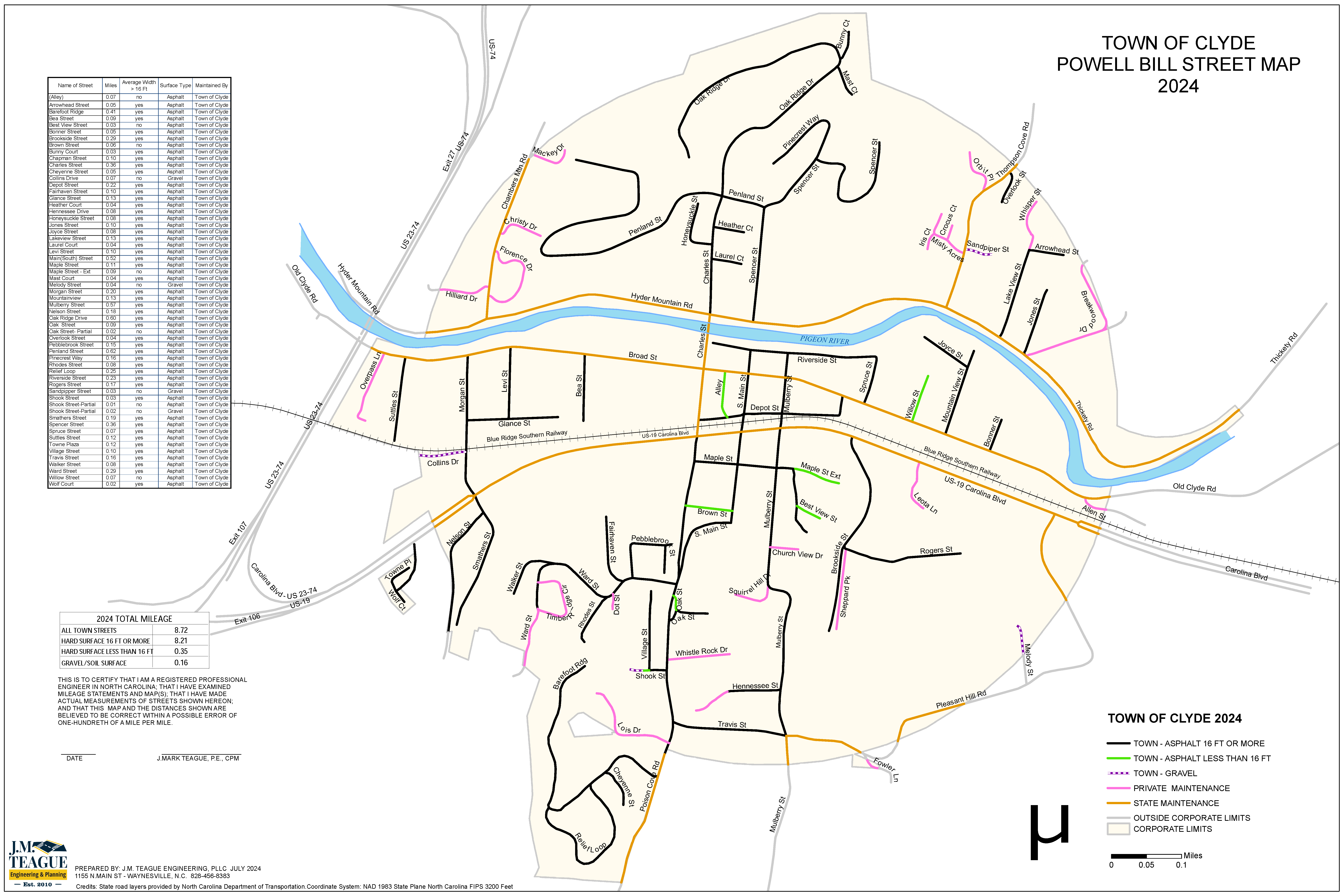
Our team uses sophisticated technology to catalog existing locations and conditions of regulatory signs, pavements, curb and gutter, sidewalks, greenways, parking lots, and ADA facilities. These are then used to create workable maps to facilitate maintenance on existing infrastructure and the construction of new infrastructure. Other mapping services are included during all types of transportation planning projects, including land use and greenway feasibility studies, Powell Bill street mapping, parking studies, detour and truck routing, traffic control planning, and wayfinding master plans. With Trimble equipment and wide-format printing capabilities, our team can efficiently develop personalized data dictionaries, collect and analyze spatial information, edit data as needed, and provide customized digital or printed maps. With these capabilities, our GIS & Infrastructure Assessment services provide deeper insight into patterns, relationships, alternatives, and other data to help clients make smarter decisions.
At JMTE, we leverage cutting-edge technology to provide detailed insights into transportation infrastructure, enabling our clients to make informed decisions that improve safety, efficiency, and connectivity. Our services include:
Using advanced tools like Trimble equipment, we catalog and assess:
We create detailed, user-friendly maps to support maintenance of existing infrastructure and the development of new projects. These maps are essential tools for:
Our team develops personalized data dictionaries, collects and analyzes spatial information, and provides precise data editing to deliver customized solutions. With wide-format printing and digital delivery options, we ensure clients receive actionable insights in the format that best meets their needs.
Our GIS and infrastructure assessment services uncover patterns, relationships, and alternatives, empowering our clients to make smarter decisions. From improving existing systems to planning new developments, our solutions are designed to align with long-term goals for safety, accessibility, and sustainability.
Let JMTE expertise in GIS and transportation planning help you optimize your infrastructure and achieve your goals. Contact us today to learn more about our comprehensive services.